
Why is it called “Charco”?
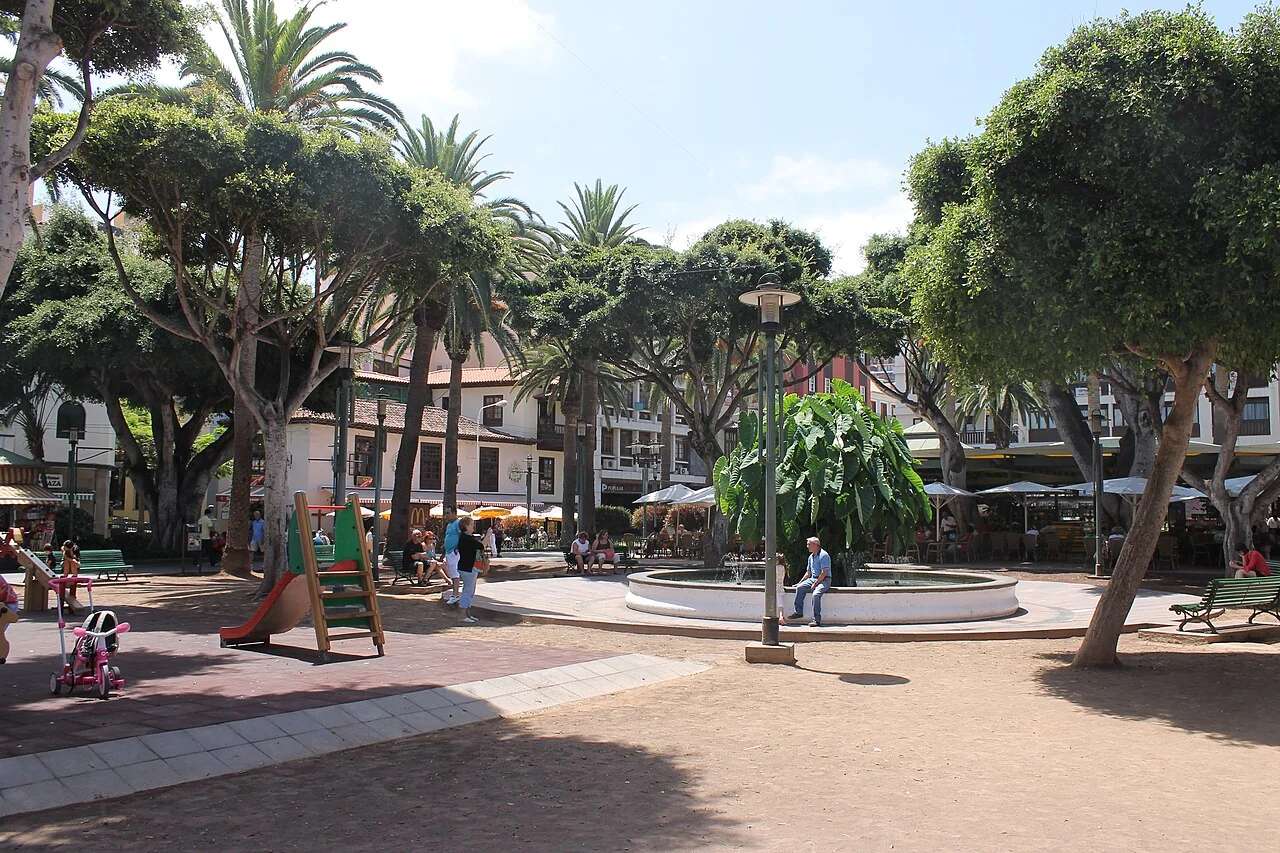
The Spanish word charco means a pool or puddle. Here the name reflects the nearby Atlantic. Local accounts connect the square with pools of seawater that formed behind the harbour. The longer name, Plaza del Charco de los Camarones, also recalls the small shrimps known as camarones.
The municipal account describes seawater pools connected underground to the ocean as early as the beginning of the 17th century. Today's name preserves the memory of this unusual earlier landscape. [1]
A planning study from the Canary Islands government explains the spatial connection: at high water, the narrow harbour entrance and the area behind it were linked to the large charco. As goods were handled here, a network of streets and buildings gradually developed around it. The square is easier to understand when considered together with the nearby harbour. [2]
A square without a single birthday
Not every historic square opened on one particular day. There is no reliable single founding year for Plaza del Charco either. The local tourism association, CIT, describes a long-established open meeting place that acquired its function as a formally arranged square in the 18th century.
An important redevelopment followed in 1835. CIT dates the paving of the promenades to 1880. Further changes came later, including a bandstand and extensive renovation in the early 1990s. Today's appearance emerged in stages. This is not an unchanged set piece from a single period, but an urban space used and adapted over a long time. [3]
That gradual evolution is part of its appeal. Looking for one construction date can obscure the essential story: successive generations have used the square, changed it and given it meaning. Its history shows how an open area close to the sea became a public centre.
A tale of two bench designs
Among the papers of chronicler and artist José Agustín Álvarez Rixo is a design from 1835 for stone benches. The historical inscription explains, in essence, that this was a second proposal; the first was selected because it was simpler and cheaper to build.
This small trace concerns cost, effort and how people should sit here. Between the major events of the city's history, it preserves a practical thought: a square also needs good places to linger. [4]
Politics changed the names; everyday life kept “Charco”
Over time, the square had several official names, including Plaza de la Constitución, Plaza Real and, during the Franco era, one honouring the dictator. Its present name again recalls the water. The local tourism account emphasises that residents continued calling it Charco through these political changes. [3]
A view recorded by Álvarez Rixo for the constitutional celebration of 1820 also shows how political occasions could transform the square. The university catalogue describes decorated entrances and temporary festive structures. The square was a place for public display as well as a space to pass through. [4]
The changing names tell the story of political eras. The enduring everyday name tells of people's attachment to a place. Both belong to its history.
Trees, shade and the famous ñamera
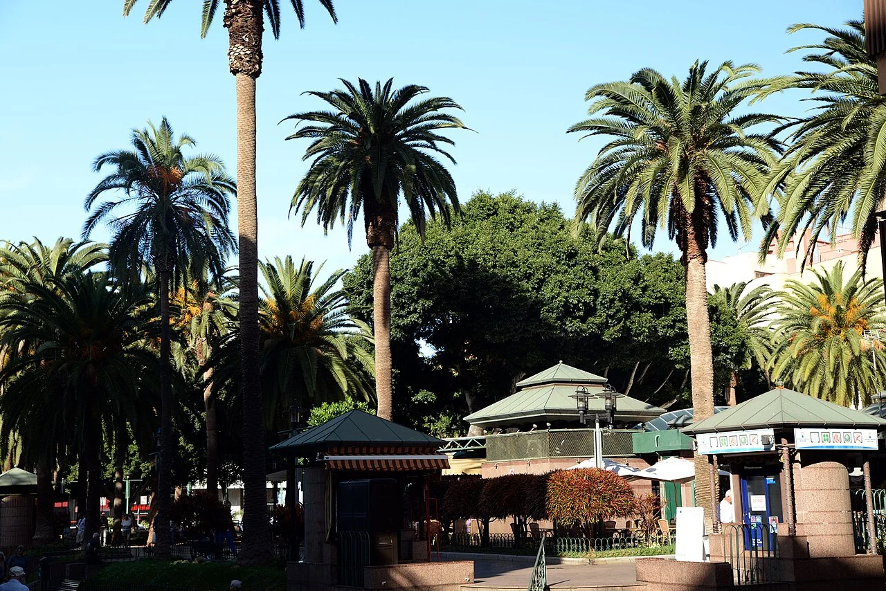
The large laureles de Indias, or Indian laurels, and Canary Island palms are among the square's distinctive features. According to the municipal account, the Indian laurels were brought from Cuba in 1852. This does not establish that every tree standing here today came from that shipment. [1]
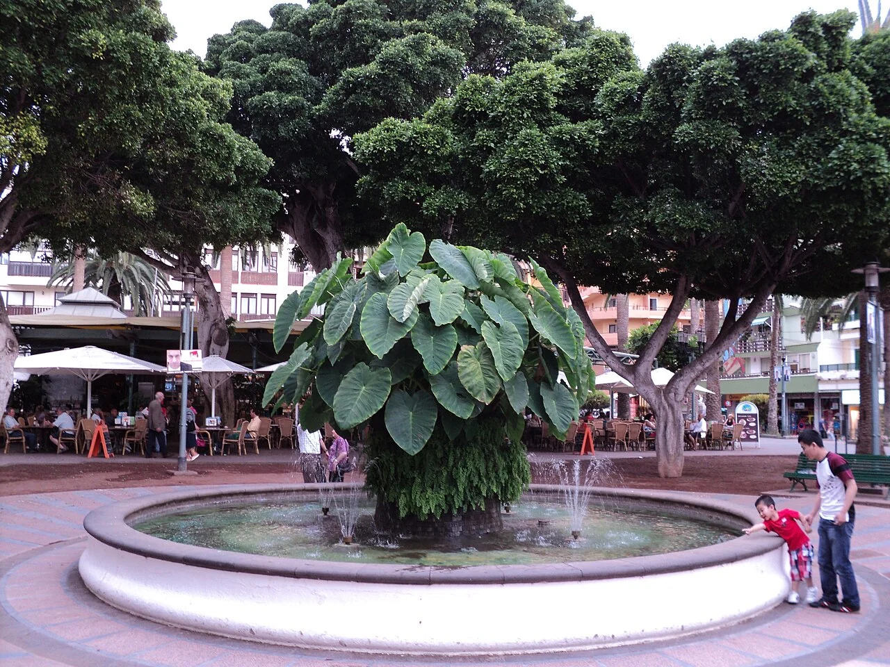
At the centre is the water basin with its ñamera. This familiar Canary Islands plant name is associated here with a much-loved image: large green leaves above the water, surrounded by the shade of trees. Tenerife's official tourism description identifies the basin and plant as surviving features of the square. [5]
The word plaza might first suggest an expanse of paving. Here, greenery, shade and different places to spend time matter just as much. The local tourism description notes the central area of earth or volcanic picón gravel and the surrounding promenade. It suits a square where walking through and staying for a while are equally natural. [6]
More than a photograph
The square's value is not limited to its history or famous plant. It is a public space that brings different people together. A geography dissertation at the University of La Laguna examined precisely this role. In 2015, Alberto Higuera Crespo studied the square through direct observation and questionnaires with residents and visitors. The work focused on its role as a place of social interaction and a connecting element within the city. [7]
This is a different perspective from a conventional list of sights. A square does not need constant spectacle to be important. It needs routes people use and places where they want to stay. At Plaza del Charco, movement and lingering belong together: meeting someone, taking a break or passing through the centre.
The well-known Dinámico also forms part of the square's social memory. The city describes it retrospectively as a gathering place for conversation within its progressive and intellectual circles. The major redevelopment, completed in 1993 according to the municipal account, retained this feature. [1]
When the harbour moved into the basin
A charming, photographically documented episode connects the square's green centre with the sea. In July 2012, the ñamera basin housed a miniature harbour landscape. A local report shows the small buildings and names the Agrupación Ranillera and the La Peñita neighbourhood association among those involved.
The basin briefly became a little ocean. Familiar places and memories were brought into the middle of the square, illustrating how closely local identity is tied to this apparently simple public space. The 2012 photographs preserve the moment when the harbour found a small stage of its own in the plaza. [8]
The harbour helps explain the square
A few steps away lies the Muelle Pesquero. The municipal description recalls Puerto de la Cruz's place among the archipelago's dynamic ports in the 18th century. It also describes today's harbour as a setting for small fishing boats, swimming and shared traditions. Its economic role has changed, but the city's connection with the sea remains. [9]
On a walk, it is worth considering square and harbour together: first the sheltered greenery and surrounding streets, then the opening towards the Atlantic. Seen this way, the square's name almost explains itself. The sea is not a distant backdrop here, but part of the place's origins.
What TeideCam shows from here
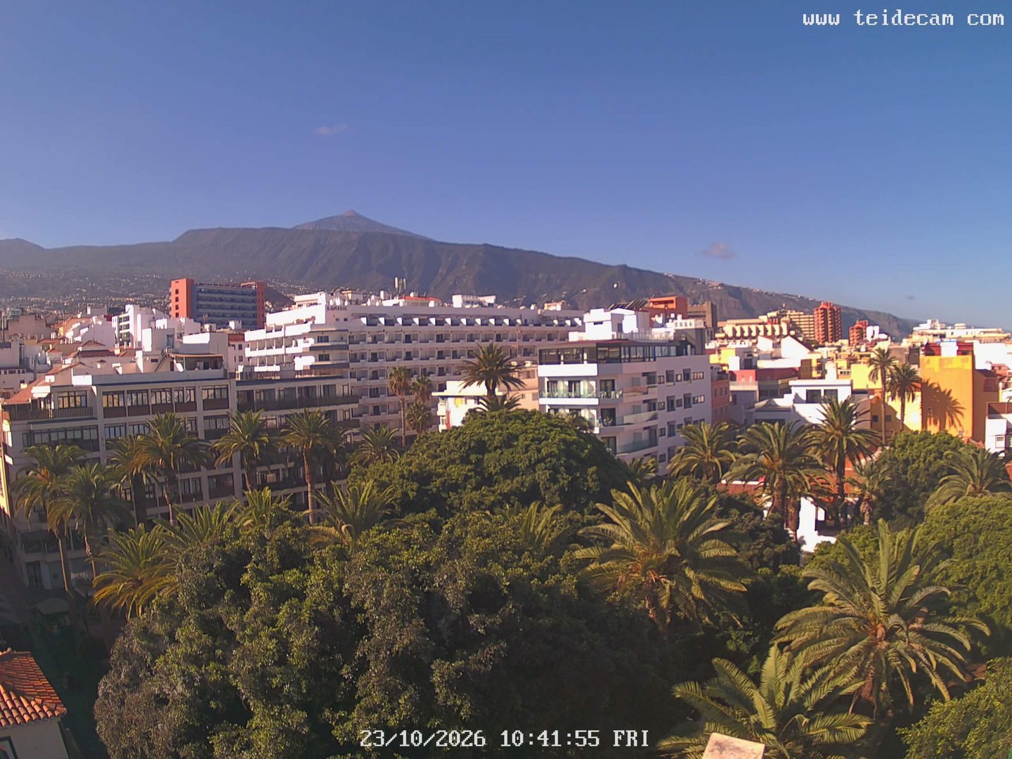
From the roof terrace above the square's northeastern corner, TeideCam looks southwest. The foreground contains the treetops of the plaza and Puerto de la Cruz's rooftops. Beyond lies the mountain landscape; the Ladera de Tigaiga forms the western boundary of the Orotava Valley. If clouds and visibility allow, Teide appears higher above.
The camera shows the relationship between city and landscape. It is not a close-up of life in the square: the basin and people on the paths are not the focus of the image. Those who know the plaza can recognise its setting in the view across the treetops. Those discovering it can see how closely everyday city life and an immense mountain backdrop sit together here.
Even when the summit is hidden, the place remains the same: a tree-shaded square a few steps from the harbour. Above it, clouds change the view. Below, Puerto de la Cruz continues its day.
Sources & further reading
- Puerto de la Cruz · Plaza del Charco ↗
- Gobierno de Canarias · Urban planning study ↗
- CIT Puerto de la Cruz · History of the square ↗
- University of La Laguna · Álvarez Rixo catalogue, pp. 168 and 242 ↗
- Turismo de Tenerife · Plaza del Charco ↗
- Wonderful Tenerife · Puerto de la Cruz ↗
- University of La Laguna · Higuera Crespo, 2015 ↗
- PUERTODELACRUZ.COM · Miniature harbour, 9 July 2012 ↗
- Puerto de la Cruz · Fishing harbour ↗