
The Atlantic supplies the moisture, the mountains shape its journey
Air often reaches Tenerife from the north or northeast. These trade winds are known in Spanish as alisios. The Azores High helps shape this circulation, bringing moist marine air across the relatively cool Atlantic. Around mountainous islands, a large-scale weather pattern becomes a very local experience: cloud cover and humidity vary considerably according to how a coast or slope faces the wind. [1]
On Tenerife's northern side, incoming air encounters rising ground. Forced uphill, it expands as the surrounding pressure falls and cools in the process. Once it reaches saturation, water vapour condenses on tiny particles to form cloud droplets. Those droplets make a cloud visible; water vapour itself is invisible.
A cloud is not an unchanging object. Droplets continually form and evaporate along its edges. A fragment of cloud can therefore keep appearing in the same place on a hillside while new air flows through it. A timelapse makes this constant formation and disappearance particularly easy to follow. [2]
Why do the clouds stop growing upwards?
In typical trade-wind weather, a drier air mass lies above the moist lower layer. Air descending within the subtropical high-pressure system warms as it sinks. Together with the cooler maritime air beneath, this creates a distinctive structure: within a certain layer, temperature increases with height. This reversal of the usual temperature pattern is called a temperature inversion.
The trade-wind inversion separates the moist marine boundary layer from the drier free troposphere above. Mixing between the two is restricted. A study of weather-balloon observations and air-mass transport over Tenerife describes this separation explicitly. [3]
For rising cloudy air, this stable structure acts as a brake. Clouds tend to spread sideways rather than develop into tall towers. Individual patches may merge into a broad cover, often of stratocumulus: low, lumpy layers of cloud. This is the mar de nubes, or sea of clouds. The name captures the view from above, where a bright, moving surface stretches between the mountainsides. From below, the same weather means an overcast sky. [4]
How high is the sea of clouds?
A single figure would imply misleading precision. Every cloud has a base, a top and a changing depth. The inversion also has lower and upper boundaries, which do not necessarily coincide with the cloud boundaries.
As a broad guide, the typical cloud belt on Tenerife's northern slopes often occupies heights of around 500 to 1,500 metres above sea level. Other local descriptions extend the range to about 1,800 metres. These are typical ranges, not fixed limits or a measurement of today's cloud base. [5] [6]
Three questions help when watching: where does the visible cloud begin, how high does it reach, and is there a clear, dry layer between it and other clouds above? Several cloud levels can coexist. The international cloud classification distinguishes low, middle and high clouds, with overlapping altitude ranges. [7]
From the Atlantic to above the clouds
A clear summit above a cloudy Puerto
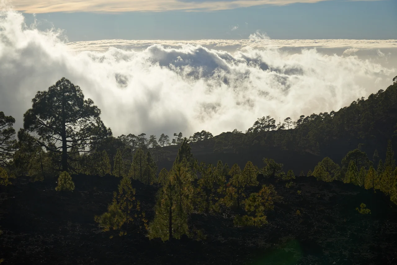
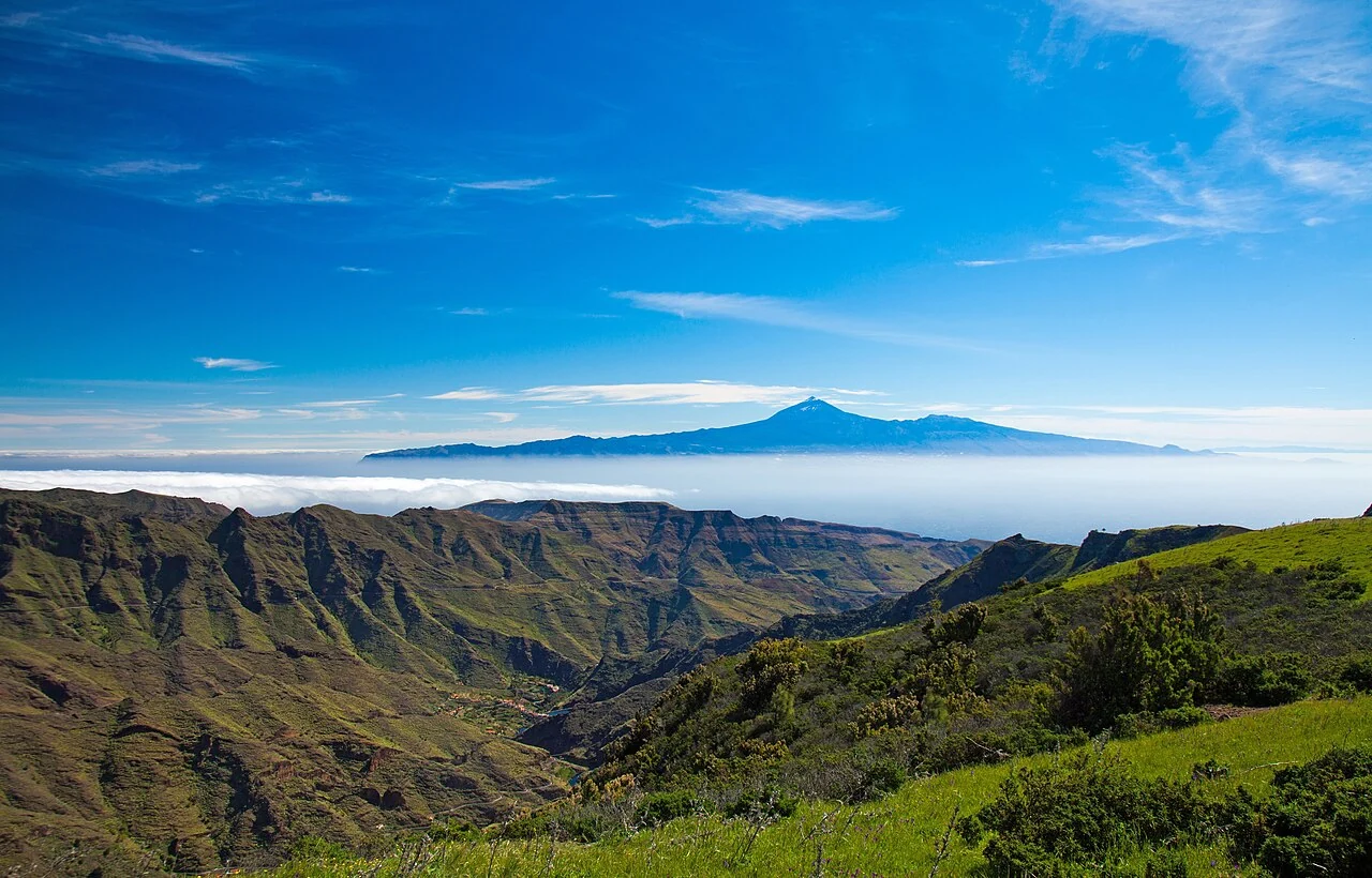
At 3,715 metres, Teide rises far above the usual trade-wind cloud belt. In stable conditions, its upper slopes can lie in dry air while the middle slopes disappear beneath a continuous cover. The Izaña Observatory, at about 2,400 metres, also frequently sits above the trade-wind inversion. Its climatological description explains this separation between moist marine air and the dry free troposphere. [8]
Yet the summit may still be invisible from Puerto de la Cruz. The camera looks diagonally through the atmosphere from the coast towards the mountain. A comparatively low cloud can block that line of sight. Seeing only grey from below does not mean the summit itself is inside a cloud.
Think of a curtain in front of a distant tower: the curtain does not have to reach the tower's top to hide it. This simple piece of geometry is just as useful for understanding the webcam view as cloud altitude.
Summer, winter and the shifting cloud boundary
The inversion does not remain at the same height throughout the year. A historical analysis of Tenerife soundings found it lower on average in July and August than between October and January. The reported ranges, roughly 770–1,380 metres in high summer and 1,360–1,850 metres in autumn and winter, refer to the inversion layer, not a guaranteed extent of cloud. The observations covered 1986–1997. [3]
The stable trade-wind structure is especially persistent in summer. A low cloud cover may linger on the northern side even while sunshine prevails above it. In winter, weather systems from the middle latitudes interrupt the trade-wind pattern more often. Atlantic depressions and their fronts can bring different winds and a different distribution of moisture. This is why “summer means sunshine, winter means clouds” is too simple. The weather pattern at the time matters most. [9]
Why the view changes during a single day
Local slope winds add to the larger circulation. As sunshine warms the mountainsides, air can flow uphill and encourage cloud development higher on the slopes. Cooling at night favours downhill flows instead. The sea of clouds can shift, retreat or sometimes disperse locally.
This helps explain why an initially clear view can cloud over later. It is not a fixed timetable: wind strength, humidity and the larger weather situation all play a part. A clear morning is neither guaranteed nor a promise of an unobstructed afternoon view. [10]
The TeideCam daily gallery is an invitation to compare these changes. Does the boundary above the rooftops stay at roughly the same level? Does the ridge disappear before the summit? Does an opening last, or close again almost immediately? These questions turn a beautiful picture into a small weather story.
The same view, a different sky
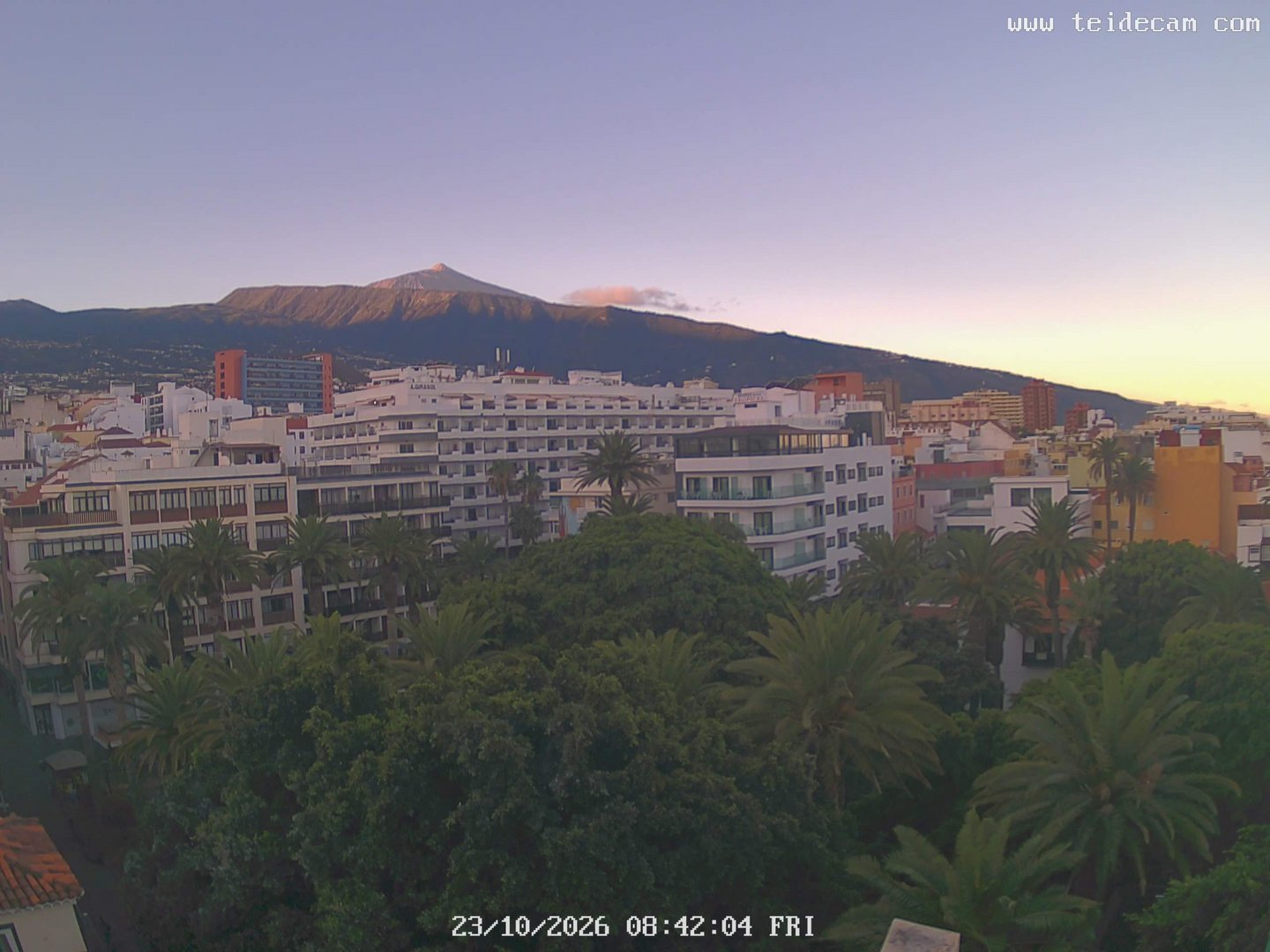
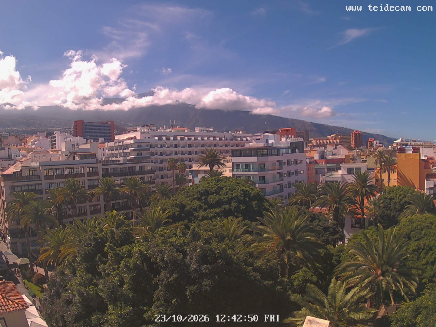
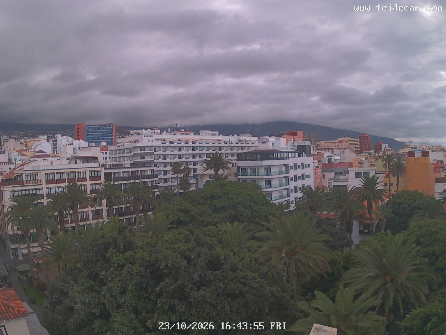
Three images from 23 October 2026: the summit is visible in the morning; later, clouds block the view. The images alone do not establish the precise cloud height.
Clouds in motion: a timelapse
A twelve-second midday excerpt from 23 October 2026. The camera clock in the video shows local capture time; this is a permanently selected example.
When are the clouds higher than Teide?
Clouds above the summit do not contradict the trade-wind inversion. The inversion is a typical but changeable structure, not a permanent limit for every cloud over the island. Three situations are worth distinguishing.
High clouds above an otherwise clear mountain
Fine cirrus strands or a cirrostratus veil can lie far above the summit. Middle-level clouds can also reach altitudes higher than Teide. Depending on climatic region, the WMO places middle-level clouds broadly between two and seven or eight kilometres; high clouds are often higher still. The summit can remain clear. A cloud seemingly touching its tip in a photograph may be far behind it; a single image does not reveal the distance. [7]
Fronts and larger changes in the weather
When the usual trade-wind pattern is interrupted, moisture may be distributed at other heights, for example in widespread cloud layers associated with a front. Izaña documents such changes in timelapses, including a frontal passage on 25 November 2012 and a snowstorm sequence in February 2014. These are different situations from the shallow, stable summer sea of clouds. [11]
Deep cumulus and thunderstorm clouds
In unstable air with enough moisture, cumulus and thunderstorm clouds can grow far above their base level. A low cloud base does not imply a low top. [7]
Even a Canary Islands summer does not rule out these developments. The Teide National Park's annual report records hail and strong convection with electrical activity on 25 August 2017. It also describes how the terrain and volcanic surfaces heated during the day can favour summer convective cloud development. This is a useful counterexample to the idea that the sky above the trade-wind layer is always cloudless. [12]
When Teide puts on a hat
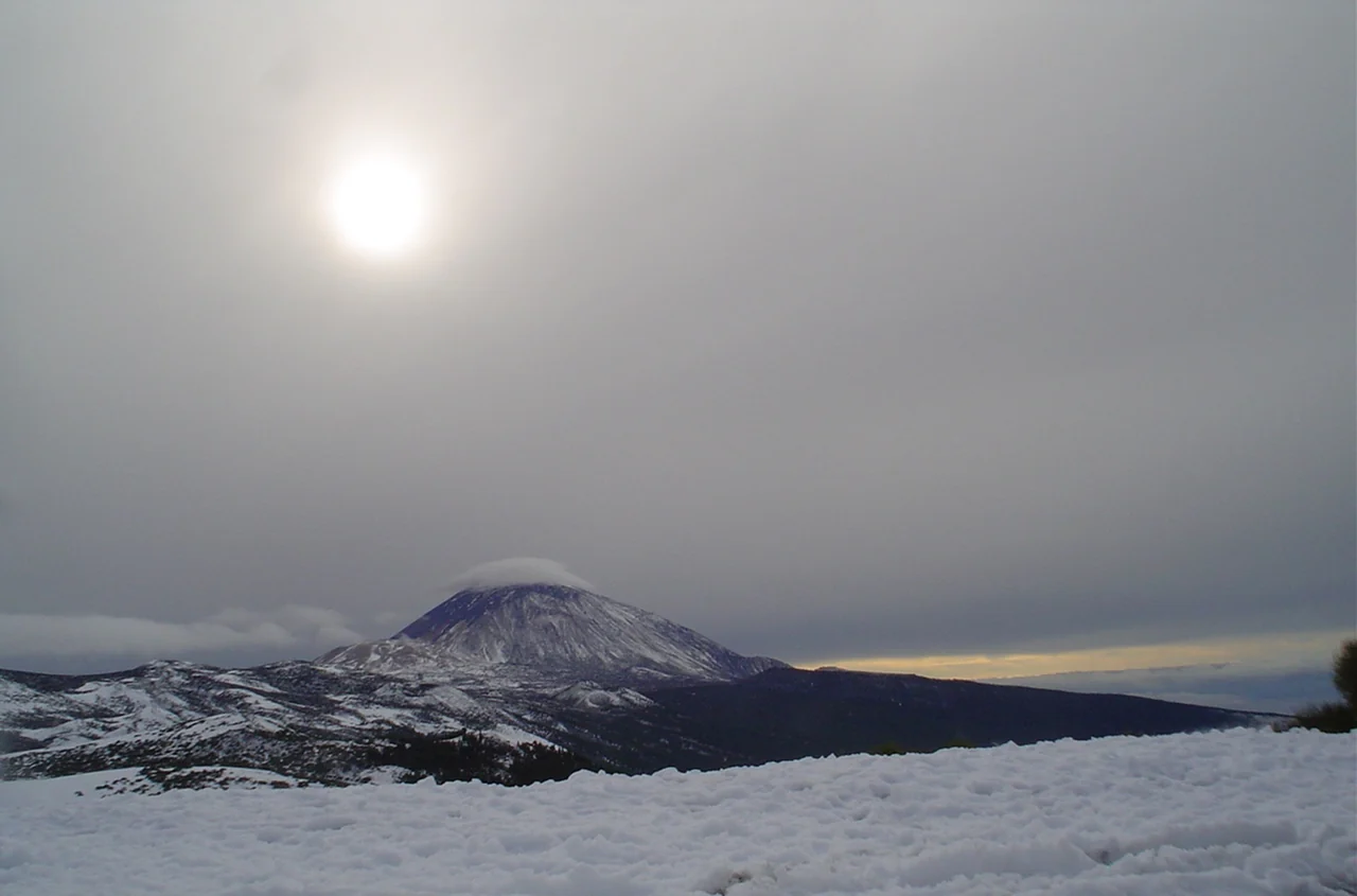
One of the most striking sights is the sombrero del Teide: a smooth, lens-shaped cloud near or above the summit, sometimes like a hat, sometimes like stacked discs. It is often a lenticular cloud.
When sufficiently moist air flows over mountains under suitable stable conditions, waves can develop in the airflow. In the rising part of a wave, the air cools and droplets form; in the descending part, they may evaporate again. The cloud can look almost stationary even while air moves rapidly through it. [13]
In traditional weather observation, Teide's hat is considered a possible sign of approaching rain. An Izaña account illustrates the physical connection: the cloud cap it describes formed in strong southwesterly flow at middle levels. AEMET explicitly notes that such a pattern can, but does not always, precede an active weather disturbance. The hat is a remarkable signal, rather than a guarantee of rain. [14]
“Panza de burro”: an everyday name for a cloudy sky
While mar de nubes evokes the bright surface of a cloud sea, panza de burro, literally “donkey's belly”, describes its grey underside. This expression is used regionally in the Canary Islands for such a cover. It is an everyday image for the experience beneath the clouds, rather than a separate meteorological cloud type.
A literary connection shows how closely this sky belongs to life in northern Tenerife. Andrea Abreu chose Panza de burro as the title of her novel published in 2020. Its setting is in the hills above Icod de los Vinos, outside the Orotava Valley, near the edge of the familiar cloud belt. An article from the Academia Canaria de la Lengua explains the link between landscape, local speech and the book's title. Weather becomes part of the world being described. [15]
Rain, drizzle and water collected from fog
A continuous cloud cover does not necessarily mean heavy rain. Low stratus may produce drizzle, but a dark underside alone tells us neither the amount of rain nor whether any is reaching the camera location. Widespread rain clouds and deep thunderstorm clouds have different characteristics from the usual shallow trade-wind cloud belt. [16]
In cloud forests, water also arrives by another route. When clouds touch vegetation, leaves, twigs and needles intercept passing droplets. Water accumulates and drips onto the ground. This is known in Spanish as lluvia horizontal, horizontal rain or fog precipitation. The clouds supply moisture even without an ordinary shower. The Canary Islands' educational platform describes this relationship especially for humid monteverde woodland. [17]
The expression does not mean ordinary rain suddenly travelling sideways. It refers to the interception of wind-carried fog droplets. Shade and high humidity also reduce drying. The Garajonay National Park guide on La Gomera explains the importance of this combination for Canary Islands laurel forests. The principle helps explain Tenerife's green cloud slopes, although local water quantities cannot simply be transferred from one island to another. [18]
Poor visibility is not always cloud
Sometimes Teide fades even without a solid cloud bank in front of it. One possible cause is calima, haze produced by very small solid particles. Mineral dust brought from Africa plays an important role in the Canary Islands. It scatters light and can greatly reduce visibility, a different physical process from the water droplets of cloud or fog.
Dust can arrive at different levels too. An AEMET study for Tenerife South Airport distinguishes low-level events from summer dust transport at middle and higher altitudes. Conditions at the coast may therefore differ from those on the mountain. A faded summit outline alone is not enough to identify a particular day as a calima event. [19]
Why evening clouds look so different
Light transforms the landscape even without a change in weather. Clouds appear white, grey or coloured depending on the light reaching them and the direction from which they are seen. When the sun is low, some undersides can glow warmly while other layers are already in shadow. High and low clouds may display very different colours at the same time. [20]
For TeideCam, this combination is the attraction: the same frame, a changing sky. The camera looks southwest from a roof terrace above Plaza del Charco. Beyond the treetops and rooftops lie the distant slopes and, when visibility allows, Teide. A timelapse reveals the changing view as clouds drift across the mountains, dissolve, uncover outlines and transform the whole scene with the light.
Returning visitors need not hope for a completely cloudless day every time. Sometimes a half-hidden Teide tells us the most about northern Tenerife.
Sources & further reading
- Turismo de Tenerife · Trade winds ↗
- NOAA · How Clouds Form ↗
- Torres et al. · Air masses over the Canary Islands ↗
- Museos de Tenerife · Sea of clouds ↗
- Turismo de Tenerife · Sea of clouds and altitude ↗
- Turismo de Tenerife · Clouds below the peaks ↗
- WMO · Cloud levels ↗
- AEMET / Izaña · Climatology ↗
- Bustos & Marrero · Trade-wind inversion ↗
- AEMET / Izaña · Technical Note 4, pp. 15–16 ↗
- AEMET / Izaña · Video gallery ↗
- Teide National Park · Annual report 2017, pp. 83–84 ↗
- AEMET · Clouds and mountain waves ↗
- AEMET / Izaña · Teide cloud cap ↗
- Academia Canaria de la Lengua · Panza de burro ↗
- AEMET / WMO · Cloud identification ↗
- Gobierno de Canarias · Laurel forest ↗
- National Parks · Garajonay guide, p. 26 ↗
- AEMET · Tenerife South airport guide, section 3.2 ↗
- WMO · Cloud colour ↗